River
Wisconsin River
692 km from source to mouth · United States.
 United StatesFlows into Mississippi River
In numbers
Length
692km
Average flow
340m³/s
Basin
31,805km²
Drop
323m
from 510 m to 187 m
Country
1
The journey
From source to mouth
692 km of river and 53 stops on the way: 10 towns and cities on its banks, dams, bridges and the tributaries that feed it.
- 0 kmSourceat 510 m
- 1 kmLac Vieux Desert18 km²
- 4 kmEleanore Lake0.8 km²
- 6 kmCrystal Lake0.3 km²
- 6 kmMoon Lake0.3 km²
- 14 kmLittle Portage Lake0.6 km²
- 26 kmLower Buckatabon Lake3.4 km²
- 43 kmEagle Rivertributary
- 44 kmWatersmeet Lake1.2 km²
- 49 kmSunset Lake0.8 km²
- 50 kmBullfrog Lake0.5 km²
- 50 kmSnipe Lake0.8 km²
- 54 kmFinley Lake0.4 km²
- 57 kmParadise Lake0.3 km²
- 65 kmPickerel Lake2.6 km²
- 67 kmCorky Lake0.4 km²
- 68 kmGilmore Lake1.1 km²
- 69 kmDog Lake11 km²
- 70 kmHasbrook Lake1.1 km²
- 71 kmDorothy Lake0.3 km²
- 72 kmHodstradt Lake0.4 km²
- 78 kmHorsehead Lake1.4 km²
- 78 kmTwo Sisters Lake2.7 km²
- 84 kmRoy Fredrich Lake0.5 km²
- 99 kmWildwood Lake8.9 km²
- 103 kmLake Julia0.9 km²
- 109 kmCrescent Lake3.1 km²
- 110 kmHat Rapids Flowage1.2 km²
- 143 kmJersey City Flowage1.6 km²
- 148 kmLake Mohawksin7.6 km²
- 169 kmGrandfather Falls
- 194 kmMerrill9,347 people
- 230 kmWausau39,994 people
- 230 kmDuey and Julia Wright House
- 234 kmBig Rib Rivertributary
- 241 kmEau Claire Rivertributary
- 254 kmMosinee4,452 people
- 270 kmLittle Eau Pleine Rivertributary
- 272 kmLake DuBay19 km²
- 294 kmStevens Point25,666 people
- 300 kmPlover12,319 people
- 326 kmWisconsin Rapids18,877 people
- 340 kmNekoosa2,449 people
- 376 kmPetenwell Lake93 km²
- 400 kmCastle Rock Lake53 km²
- 435 kmWisconsin Dells2,942 people
- 438 kmLake Delton0.9 km²
- 472 kmPortage10,382 people
- 480 kmBaraboo Rivertributary
- 480 kmColumbia Lake, Wisconsin1.5 km²
- 514 kmLake Wisconsin32 km²
- 560 kmSpring Green1,828 people
- 566 kmBakkens Pond0.4 km²
- 646 kmKickapoo Rivertributary
- 692 kmMississippi Riverat 187 m
Water level along the river (RiverATLAS; the height is exaggerated). Towns: GeoNames and Wikidata; bridges, dams and tributaries: Wikidata.
River in Wisconsin, United States
At the mouth it carries 340 m³/s on average: an Olympic pool every 7.4 seconds. It drops from 510 m to 187 m, 0.5 m per kilometre on average. Its basin covers 31,805 km², about the size of BE. 617,000 people live in it. Highest water: from May to June; lowest: from December to March. Dams and reservoirs hold back a large share of its water (20% of a year's flow).
Where to start
- WausauLargest city on its banks · 39,994 people
- Central Wisconsin Airport (CWA)Nearest airport with scheduled flights, 19 km from the cityCar hire at ATW airport (Appleton)Discover Cars · Affiliate link↗
- On the water132 ferry piers, marinas, boat rentals and boat ramps along the river (OpenStreetMap)
- Kayak and canoe6 put-ins and rapids mapped (OpenStreetMap)
- From May to SeptemberThe best months to visit
Wisconsin River, month by month
Highest water: from May to June
Lowest water: from December to March. Freezing months (average below −4 °C): from December to February. Best months to visit: from May to September.
From about 200 m³/s in the lowest month to 490 m³/s in the highest. An estimate: the monthly flow is modelled from the lowest and highest months of WaterGAP (RiverATLAS, 1971–2000) and the rain and snow along the river (WorldClim). Dams change the real rhythm. The chip is the average air temperature; below it, the month's rain.
Plan the trip
Plan the trip: boat trips, a bed by the river, a car
Some links above are affiliate links: if you book through them we may earn a commission, at no extra cost to you. It never changes what the data on this page says.
The basin
Wisconsin River: the basin in numbers
31,150 km² of land send their water to this river. This is what lives on it.
- 617,000people live in the basin
- 21/km²people per km²
- 371maverage altitude of the basin
- 819mmof rain a year (basin average)
- 6.0°Caverage air temperature
- 7%protected areas
- 2.6%covered by lakes
- 1.8km³held in reservoirs
What covers the basin
- 68% Forest
- 23% Cropland
- 6% Pasture
- 1% Towns and cities
RiverATLAS (HydroATLAS v1.0, CC BY 4.0): land cover, people, protected areas, glaciers and dams over the whole basin upstream of the mouth.
Along the river
Wisconsin River: what you find on the way
- 2Weirs
- 10WaterfallsBridal Veil Falls and 9 more
- 4RapidsWhirlpool Rapids, Posey Rapids, Bill Cross Rapids and 1 more
- 2Canoe put-ins
- 110Boat rampsMoon Lake Boat Launch, Spirit River Flowage - Mill Landing, Gilbert Park Boat & Kayak Launch and 107 more
- 2Ferry piersMerrimac Ferry (Colsac III)
- 16MarinasLake Wisconsin Boat Club and 15 more
- 8River beachesHodag Beach, Sara Park Beach, Park Road Beach and 5 more
From OpenStreetMap, within 2.1 km of the river. Not mapped is not the same as not there.
Cross-checked with our atlases
Wisconsin River in our other atlases
What our sister atlases know about the waterfalls on this river, the lakes it flows through, the beaches at its mouth, the mountains where it rises and the islands off its mouth.
 1waterfall on the riverCascadyas
 35lakes on its wayLakeyas
 1mountain at the sourcePeakyas
Waterfalls (1)
On the river, by Cascadyas
- Grandfather Fallskm 158
Cascadyas is coming soonOpen Cascadyas ↗
Lakes and reservoirs (35)
Lakes it flows through, by Lakeyas
- Lac Vieux Desertkm 1 · 12 m deep18km²
- Dog Lakekm 6511km²
- Lake Mohawksinkm 1387.6km²
- Lake DuBaykm 25419km²
- Petenwell Lakekm 35193km²
- Castle Rock Lakekm 375 · 11 m deep53km²
- Lake Deltonkm 4100.9km²
- Lake Wisconsinkm 481 · 12 m deep32km²
27 more on LakeyasLakeyas is coming soonOpen Lakeyas ↗
Mountains at the source (1)
Within 15 km of the source, by Peakyas
- Military Hill8.2 km away
From space
The source and the mouth, seen from orbit
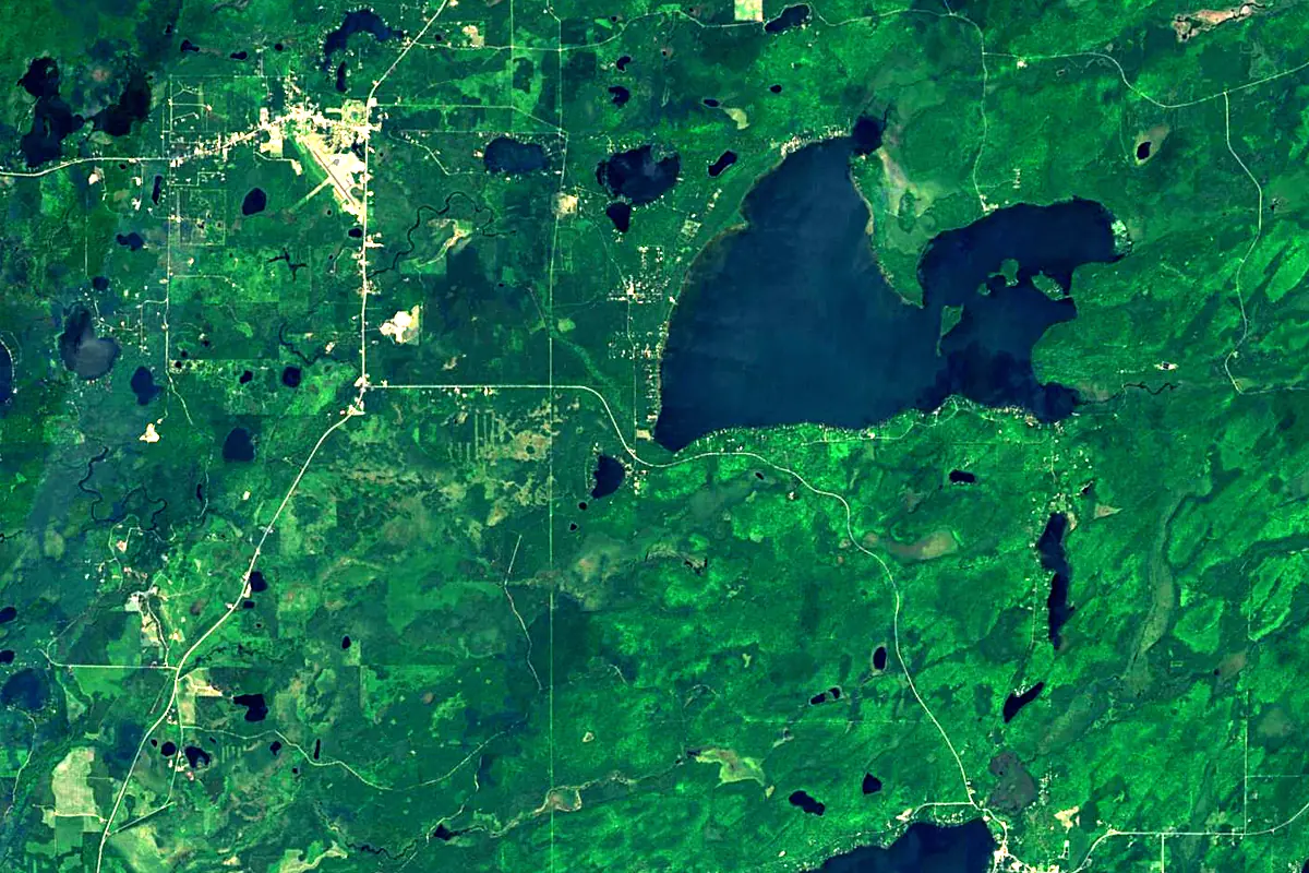
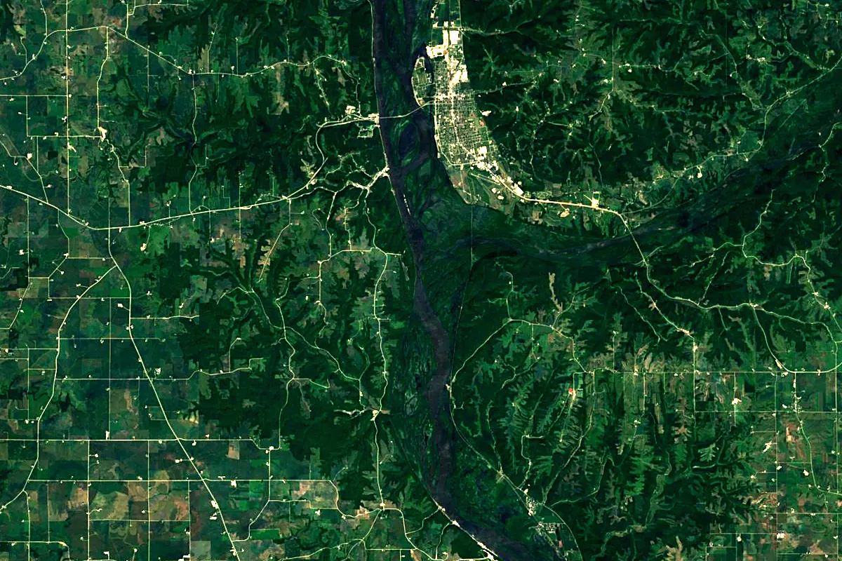
Sentinel-2 cloudless 2016 by EOX IT Services GmbH (contains modified Copernicus Sentinel data 2016), CC BY 4.0. The glowing line is the river as drawn by RiverATLAS.
Photos
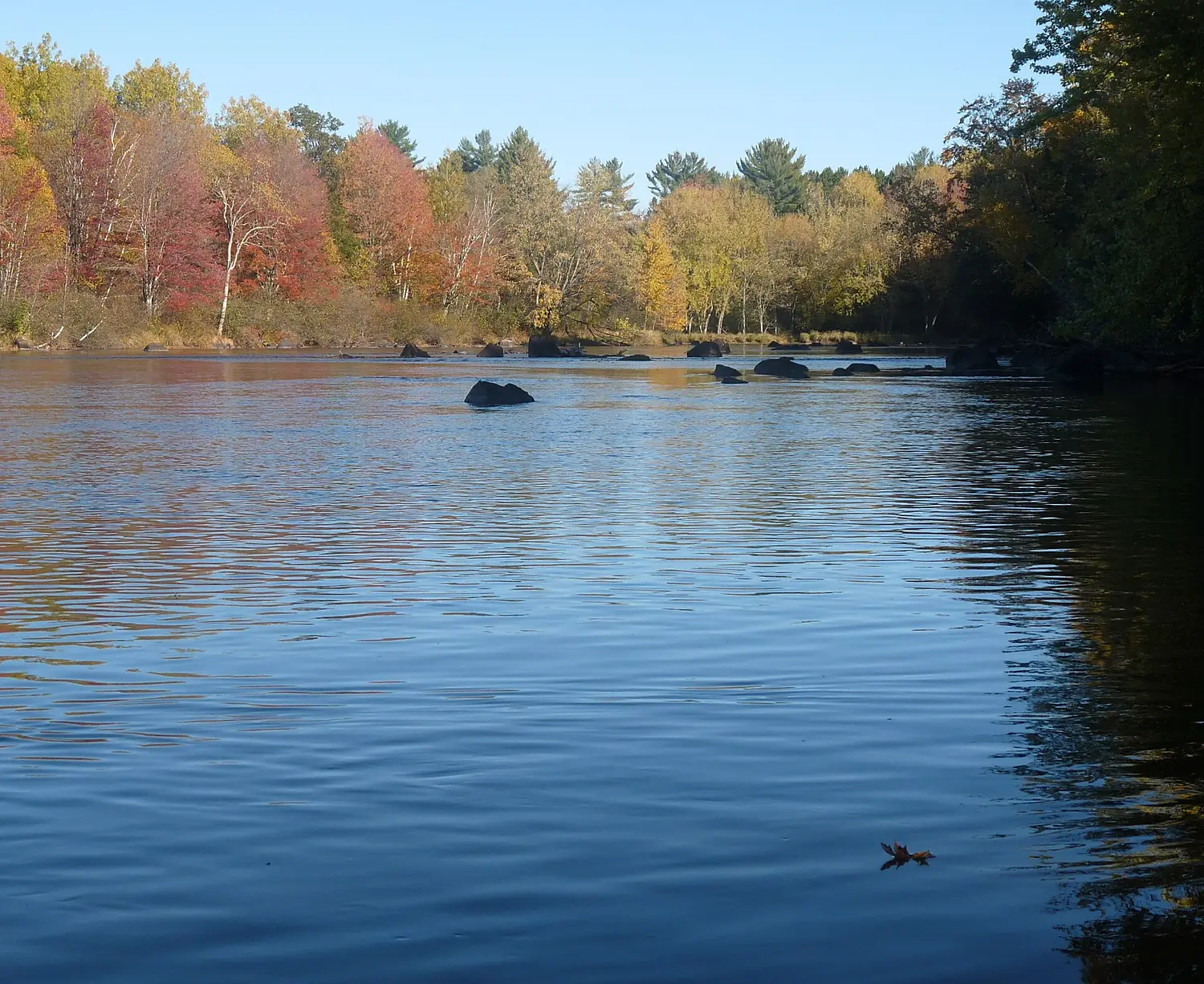
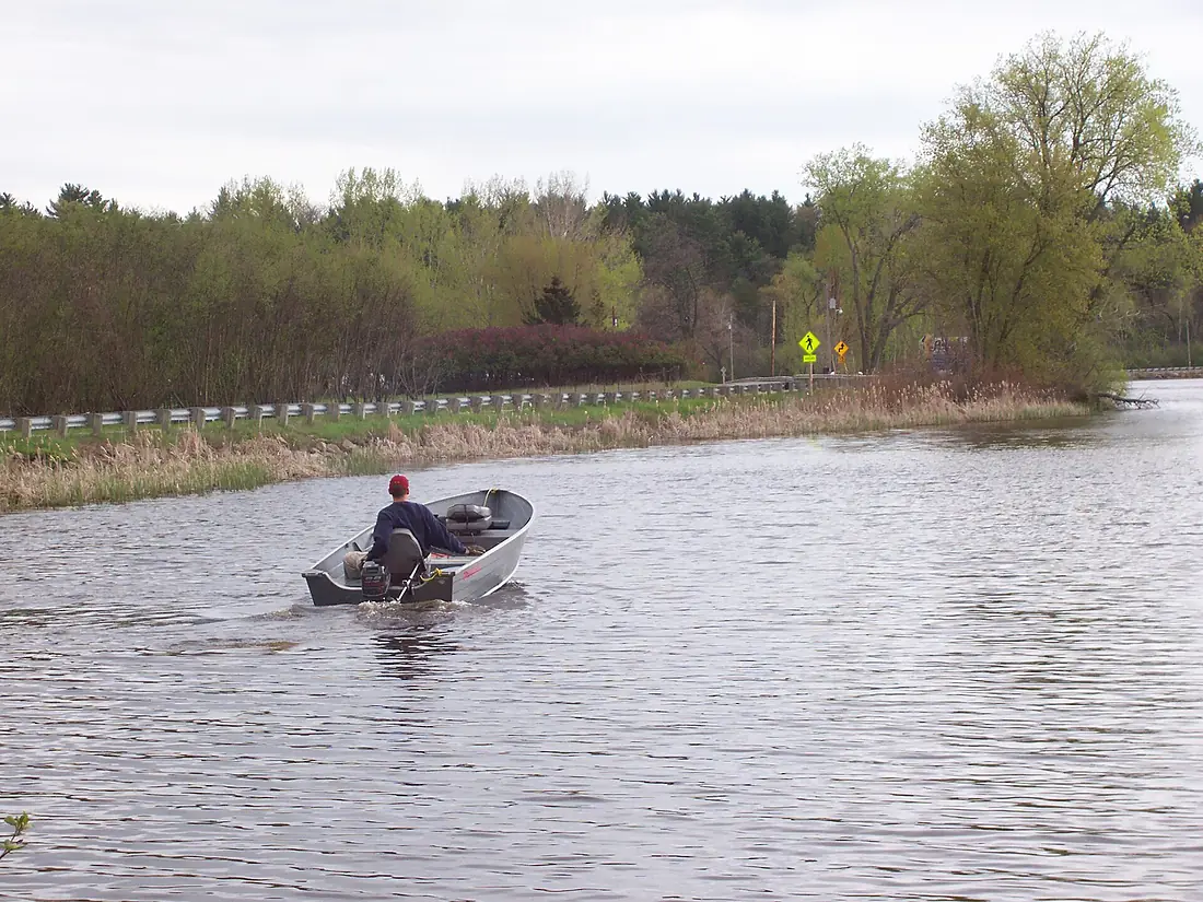
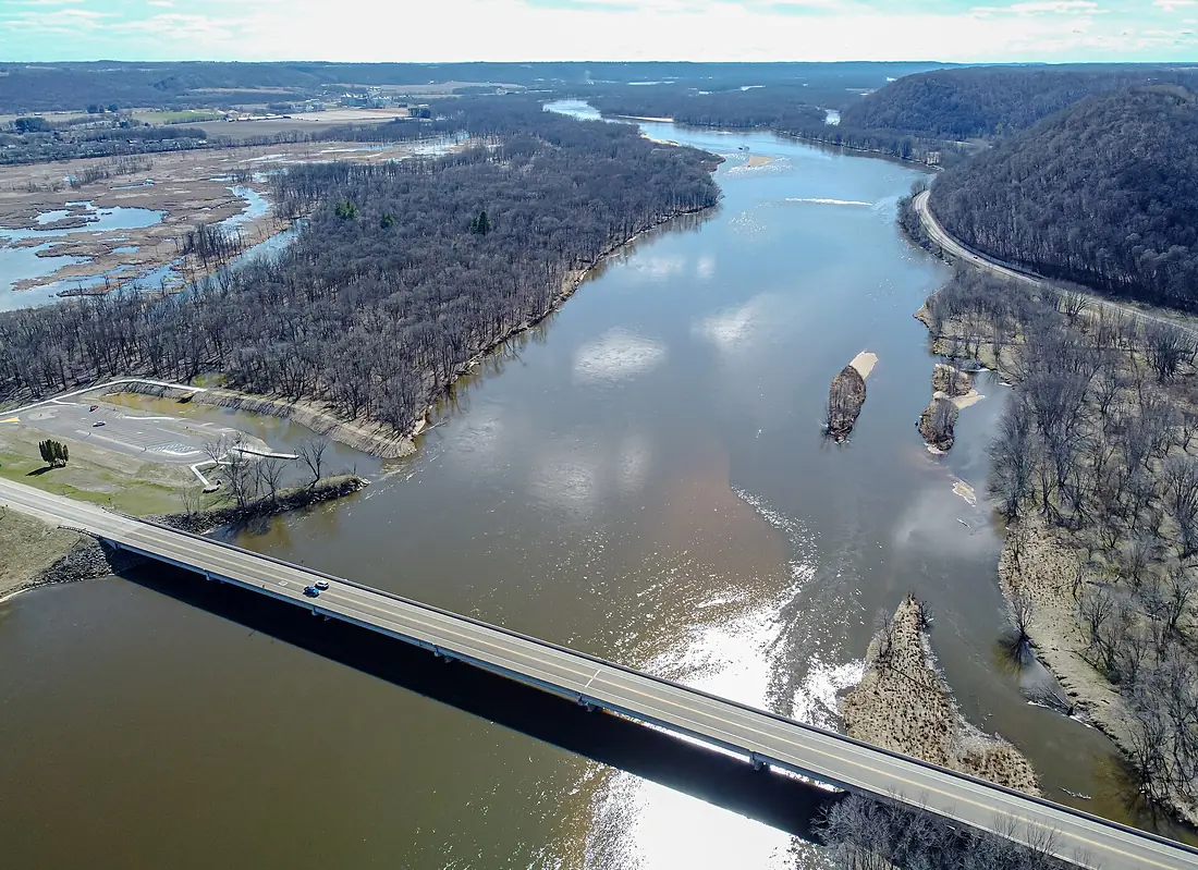
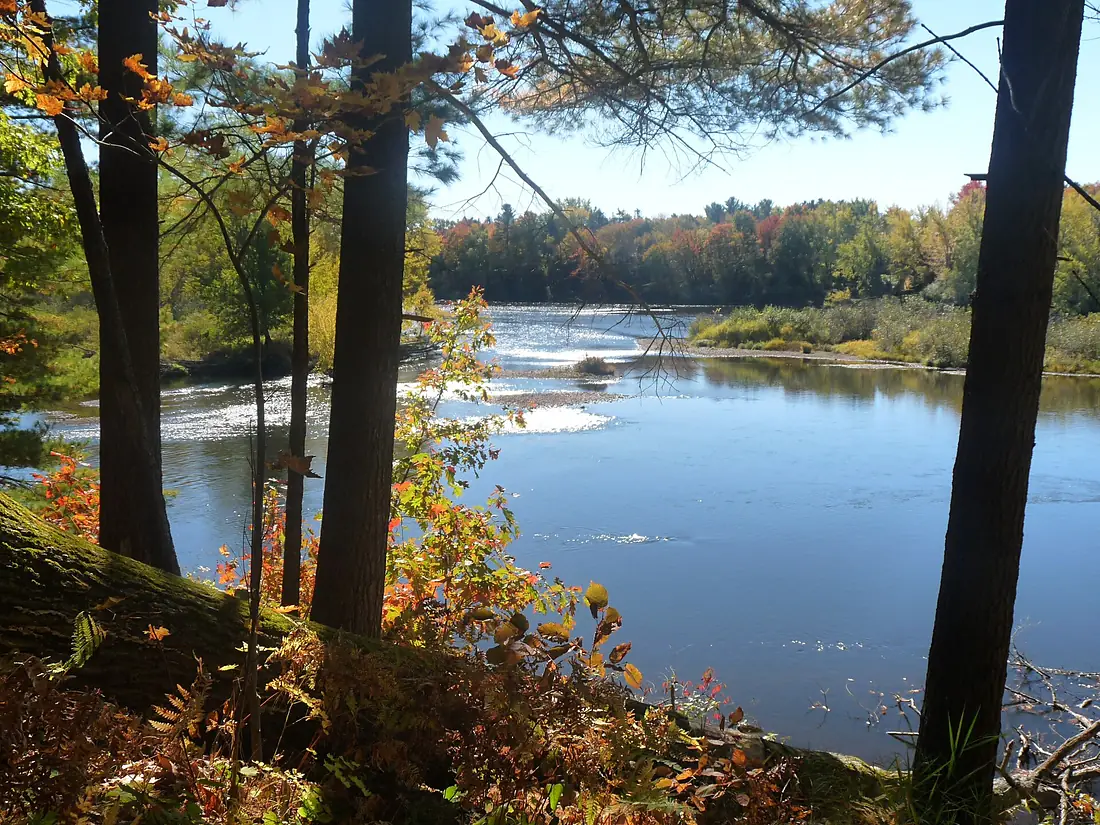
Wisconsin River in pictures
Tributaries
Where it flows, and what flows into it
It flows into
Mississippi RiverUnited States3,766 km12,700 m³/sTributaries (12)
Also: Baraboo River, Little Eau Pleine River, Kickapoo River, Eagle River, Big Eau Pleine River, Eau Claire River, Big Rib River, New Wood River, Pelican River, Otter Creek, Mill Creek, Tenmile Creek
In the same basin
United States3,726 km2,500 m³/sOhio RiverUnited States1,579 km8,000 m³/sArkansas RiverUnited States2,364 km240 m³/sTennessee RiverUnited States1,049 km2,000 m³/sRed RiverUnited States2,189 km1,900 m³/sYellowstone RiverUnited States1,114 km390 m³/sPlatte RiverUnited States500 km200 m³/sCanadian RiverUnited States1,458 km200 m³/sIllinois RiverUnited States432 km660 m³/sAllegheny RiverUnited States523 km560 m³/sNearby
Rivers nearby
United States459 km190 m³/s173 km awayIowa RiverUnited States520 km280 m³/s203 km awayMinnesota RiverUnited States534 km120 m³/s266 km awayDes Moines RiverUnited States845 km250 m³/s291 km awayMissouri RiverUnited States3,726 km2,500 m³/s473 km awayPlatte RiverUnited States500 km200 m³/s445 km awayIllinois RiverUnited States432 km660 m³/s451 km awayJames RiverUnited States1,143 km18 m³/s496 km awayWhere these numbers come from
| Name, length, places | Wikidata (Q978496) · CC0 |
|---|---|
| Course, profile, basin | RiverATLAS v1.0 (HydroATLAS, Linke et al. 2019) · CC BY 4.0 — followed from the source to the mouth given by Wikidata |
| Flow | WaterGAP (RiverATLAS), 1971–2000 · CC BY 4.0 |
| Climate along the river | WorldClim (RiverATLAS), 1970–2000 · CC BY 4.0 |
| Towns, bridges, dams | Wikidata · CC0; GeoNames · CC BY 4.0 |
| Along the river | © OpenStreetMap contributors · ODbL |
| Images | EOX Sentinel-2 cloudless 2016 · CC BY 4.0; Wikimedia Commons |
| Our other atlases | Cascadyas, Lakeyas, Peakyas — Wikidata · CC0; © OpenStreetMap contributors · ODbL; GeoNames · CC BY 4.0; HydroLAKES · CC BY 4.0; NOAA OISST |
Every source and licence is on the data sources page.
The family
Do you prefer beaches, lakes, mountains, waterfalls, islands, rivers or canyons?
Same idea, other landscapes: field atlases built on open data, month by month, in seven languages.
 beaches
 Find your beach: sea temperature, sun and swimming month by month.Visit lakes
 Every lake on Earth: water temperature, ice, depth and the shore.Coming soonVisit mountains
 Every summit in 3D: summit weather, the 0 °C line, huts and trails.Visit waterfalls
 Every waterfall: height, flow month by month and when it roars.Coming soonVisit
  islands
 Every island from the sea up: size, sea temperature, ferries and 3D.Coming soonVisit
  rivers
 Every river from source to sea: the journey, the flow and the basin in numbers.You are here
 canyons
 Every canyon cut to scale: depth to the floor, rim and floor temperatures, trails and viewpoints.Coming soonVisit